
Best Counties for Homesteading in Montana
April 2026 · Based on federal data from 9 agencies
Montana draws homesteaders with a policy stack that's hard to argue with on paper: constitutional carry statewide for anyone 18 and older (HB 102, 2021; MCA 45-8-317), no mandatory residential building code outside incorporated municipalities (MCA 50-60-101), a right-to-farm law that protects established operations from nuisance suits (MCA 27-30-101), and agricultural land assessed at productive capacity rather than market value — which can slash your effective tax rate to 0.3–0.5% on working farm ground. The effective statewide rate on all property runs around 0.74%. And the sheer scale of the place — 147,000 square miles with under 1.1 million people — means privacy and elbow room that most states can't match at any price.
But Montana is not a simple homesteading state, and the people who arrive with a romantic picture of it often leave with a harsher one. The growing season in most of the state runs 80–120 frost-free days — short enough that row crops without season extension are a gamble. The wildfire insurance market is in crisis: Montana has the highest share of high-risk properties of any state (29%), no FAIR Plan insurer of last resort, and carriers have stopped writing new policies in entire valleys. Water rights under prior appropriation doctrine (MCA 85-2-101) are legally complex, actively contested in a statewide adjudication still working through 218,000+ pre-1973 claims, and as of January 1, 2026, all new groundwater users must file a Notice of Intent with DNRC before drilling. The state also has a state income tax — 4.7%/5.9% in 2025, on a legislated glide path down to 4.7%/5.4% by 2027 (HB 337, 2025 session).
We ran federal data from FEMA, Census ACS, NOAA, USDA, and five other agencies across all 56 Montana counties. Here is what the numbers actually show.
Rankings reflect county-level averages from federal data sources — your specific parcel will differ based on location, soil type, and local ordinances. This is a research starting point, not professional real estate or legal advice. See our methodology for data sources, freshness, and known limitations.
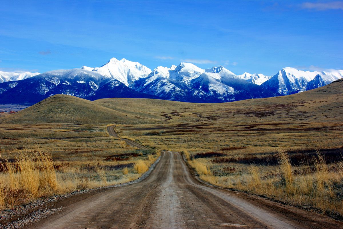
Montana Counties
Click any county to view its full data profile. Colors show overall natural disaster risk from FEMA's National Risk Index.
Lowest Property Tax
Montana taxes agricultural land at 2.16% of productive capacity value — not market value. On ground trading at $1,500/acre with a USDA-assigned productivity value of $200/acre, the effective tax rate on what you paid can fall well under 0.5%. The counties below have the lowest median annual property tax bills in the state. Most are in the eastern plains and central Montana, where sparse population and low land productivity combine to produce genuinely low carrying costs.
| # | County | Property Tax | Median Home | Population |
|---|---|---|---|---|
| 1 | Wibaux County | $700 | $101,800 | 1,119 |
| 2 | Carter County | $883 | $140,900 | 1,332 |
| 3 | Golden Valley County | $929 | $138,900 | 841 |
| 4 | Judith Basin County | $974 | $206,000 | 2,039 |
| 5 | Wheatland County | $1,061 | $163,200 | 2,060 |
| 6 | Rosebud County | $1,085 | $159,900 | 8,310 |
| 7 | Powder River County | $1,236 | $167,500 | 1,773 |
| 8 | Glacier County | $1,244 | $139,400 | 13,781 |
| 9 | Treasure County | $1,263 | $210,700 | 680 |
| 10 | Petroleum County | $1,298 | $152,600 | 416 |
Longest Growing Season
Montana's growing seasons are honest and short. The Yellowstone River corridor near Billings and the southern foothill counties get the most frost-free days — up to 120–140 days at the valley floor. Western valleys like the Bitterroot and lower Flathead run 100–130 days. The Hi-Line and mountain counties can drop to 80–90 days or fewer, with last frost dates stretching into late May and first fall frost arriving by mid-September. Statewide, high tunnels and unheated greenhouses are not optional equipment for anyone serious about food production — they're baseline infrastructure.
| # | County | Growing Days | Hardiness Zone | Precipitation |
|---|---|---|---|---|
| 1 | Beaverhead County | 67 days | 5a | 14.4" / yr |
| 2 | Carbon County | 67 days | 5a | 14.4" / yr |
| 3 | Big Horn County | 66 days | 5a | 14.3" / yr |
| 4 | Gallatin County | 66 days | 5a | 14.3" / yr |
| 5 | Madison County | 66 days | 5a | 14.3" / yr |
| 6 | Park County | 66 days | 5a | 14.3" / yr |
| 7 | Powder River County | 66 days | 5a | 14.3" / yr |
| 8 | Stillwater County | 65 days | 5a | 14.3" / yr |
| 9 | Sweet Grass County | 65 days | 5a | 14.2" / yr |
| 10 | Deer Lodge County | 64 days | 4b | 14.2" / yr |
Lowest Natural Disaster Risk
Montana's eastern plains counties score consistently low across FEMA's National Risk Index — minimal tornado exposure, negligible hurricane and earthquake risk, and low population density that limits community vulnerability scores. The elevated-risk counties are concentrated in the northwest (wildfire and flooding in forested drainages) and the Yellowstone River urban corridor (Yellowstone, Cascade, Gallatin counties carry moderate composite scores due to population and wildland-urban interface exposure). The counties below are ranked by FEMA's composite score.
| # | County | Overall Risk | Tornado | Flood | Disasters |
|---|---|---|---|---|---|
| 1 | Broadwater County | Very Low | Very Low | Very Low | 8 |
| 2 | Carter County | Very Low | Very Low | Very Low | 6 |
| 3 | Chouteau County | Very Low | Very Low | Relatively Low | 6 |
| 4 | Custer County | Very Low | Very Low | Relatively Low | 7 |
| 5 | Daniels County | Very Low | Very Low | Very Low | 4 |
| 6 | Deer Lodge County | Very Low | Very Low | Very Low | 8 |
| 7 | Fallon County | Very Low | Very Low | Very Low | 5 |
| 8 | Garfield County | Very Low | Very Low | Very Low | 8 |
| 9 | Golden Valley County | Very Low | Very Low | Very Low | 8 |
| 10 | Granite County | Very Low | Very Low | Very Low | 3 |
Most Affordable (Median Home Value)
Montana land prices bifurcated sharply after 2020. Gallatin County (Bozeman area) now sees parcels above $50,000/acre near town. Ravalli County's Bitterroot Valley runs $5,000–$20,000+/acre. But the eastern plains tell a different story: USDA 2025 data puts statewide average pastureland at $920/acre, and several Hi-Line and southeastern counties still offer dryland and range ground under $2,000/acre. The cheapest median home values in the data are in counties that are genuinely remote — the trade is low carrying cost for distance from hospitals, services, and supply chains.
| # | County | Median Home | Property Tax | Population |
|---|---|---|---|---|
| 1 | Wibaux County | $101,800 | $700 | 1,119 |
| 2 | Roosevelt County | $112,800 | $1,487 | 10,799 |
| 3 | Liberty County | $118,300 | $1,308 | 1,993 |
| 4 | Blaine County | $119,400 | $1,872 | 7,030 |
| 5 | Sheridan County | $121,800 | $1,459 | 3,700 |
| 6 | Golden Valley County | $138,900 | $929 | 841 |
| 7 | Glacier County | $139,400 | $1,244 | 13,781 |
| 8 | Prairie County | $140,600 | $1,421 | 1,283 |
| 9 | Carter County | $140,900 | $883 | 1,332 |
| 10 | Petroleum County | $152,600 | $1,298 | 416 |
Best for Off-Grid Living
Montana has no mandatory statewide residential building code outside incorporated areas — farm and ranch buildings on agricultural parcels of 160+ acres are explicitly exempt from state building code enforcement (MCA 50-60-101). Rainwater harvesting is legal (MCA 75-6-101). Off-grid solar is unrestricted. The practical constraints are different: composting toilet legality is county-by-county through local health departments; eastern counties tend toward permissive enforcement. The composite ranking below weights low property tax, high solar irradiance (NREL), and low population density. Eastern counties dominate partly because their sparse populations depress the community vulnerability penalty.
| # | County | Solar (kWh/m²) | Property Tax | Population |
|---|---|---|---|---|
| 1 | Wibaux County | 3.7 | $700 | 1,119 |
| 2 | Carter County | 3.9 | $883 | 1,332 |
| 3 | Golden Valley County | 3.8 | $929 | 841 |
| 4 | Judith Basin County | 3.7 | $974 | 2,039 |
| 5 | Wheatland County | 3.8 | $1,061 | 2,060 |
| 6 | Powder River County | 3.9 | $1,236 | 1,773 |
| 7 | Rosebud County | 3.8 | $1,085 | 8,310 |
| 8 | Treasure County | 3.8 | $1,263 | 680 |
| 9 | Petroleum County | 3.7 | $1,298 | 416 |
| 10 | Garfield County | 3.7 | $1,342 | 976 |
What to Watch Out For
Montana has a reputation that precedes it — and the gap between the fantasy and the operational reality catches buyers who didn't do the work.
Water rights are not guaranteed — even with a well
Montana operates under strict prior appropriation: senior rights holders can legally call a shut-off on junior users during drought. The state is still adjudicating 218,000+ pre-1973 water rights through the Water Court — when you buy land with claimed historical rights, those rights are not yet final. The Court may modify volume, priority date, or diversion point from what the seller represents. Title insurance typically does not cover water rights. Get a DNRC abstract and have a water rights attorney review it before closing. Also note: as of January 1, 2026, all new groundwater appropriations (including domestic exempt wells) now require filing a Notice of Intent (Form 602I) with DNRC before drilling (MCA 85-2-306; ARM 36.12).
Wildfire insurance is in crisis — and Montana has no FAIR Plan
Montana has the highest percentage of high-risk wildfire properties of any U.S. state (29%), and its home insurance market is in active retreat. Multiple major carriers have stopped writing new policies in western valleys like the Bitterroot and Flathead. Premiums rose 18–22% statewide in 2024–2025 alone. Unlike California, Florida, and other high-risk states, Montana has no state-backed FAIR Plan insurer of last resort — if the private market won't cover you, you have no fallback. The state auditor issued a non-binding moratorium on wildfire-related cancellations in mid-2025, but it is advisory only. Verify insurability with at least three carriers before making an offer on any western Montana property.
Easement and road access disputes are endemic
An outsized share of rural Montana parcels are landlocked or depend on easements across neighboring land for road access. Disputes about maintenance obligations, permissible vehicle types, and whether the easement is legally documented at all are among the most common rural legal conflicts in the state. A verbal agreement with the previous owner is not binding on a new neighbor. Before closing, confirm the easement is recorded in the county deed records, clearly describes the route and allowed uses, and specifies who bears maintenance costs. Do not assume.
Mineral rights are commonly severed — and not always disclosed
Montana allows mineral rights to be severed from surface rights, and many rural parcels were severed decades ago during oil, gas, and coal leasing activity. A third-party mineral rights owner has legal access to your land for extraction purposes even without your consent. Standard deed searches often miss split mineral ownership. Order a separate mineral title search and understand what, if anything, the subsurface owner holds before you buy — especially in any county with historical energy or mining activity (Rosebud, Powder River, Custer, Big Horn, and any county near the Bakken formation).
Grizzly bears are expanding — not retreating
Grizzly bears are active across northwest Montana (Flathead, Lincoln, Glacier, Sanders, Mineral counties) and the Greater Yellowstone Ecosystem (Gallatin, Park, Madison counties), and confirmed sightings are now arriving from ranges previously considered outside their historic territory — including the Tobacco Root Mountains and parts of southwest Montana. Livestock predation by grizzlies, wolves, and mountain lions is a recurring, practical problem — not a theoretical one. If your operation includes poultry, goats, or small livestock anywhere in western Montana, electric fencing for enclosures and bear-proof feed storage are not optional. Budget for it before you buy.
Montana at a Glance
Property Tax
0.74% effective rate
Ag land assessed at productive capacity — effective rate can fall under 0.5%
Gun Laws
Constitutional Carry
HB 102 (2021), age 18+. No permit required, open carry legal statewide
Water Rights
Prior Appropriation
Domestic exempt wells: 35 gpm / 10 acre-ft/yr; NOI required as of Jan 1, 2026
Building Codes
No Statewide Code
Rural ag parcels 160+ acres exempt; municipalities may adopt local codes
Right to Farm
Protected
MCA 27-30-101 — operations predate complaining party; $1,500/yr income threshold
Cottage Food
No Sales Cap
Montana Local Food Choice Act (2021 SB 199, amended 2023 SB 202) — includes raw milk direct sales
Homeschool
Annual Notice Required
MCA 20-5-109; no testing required; 1,080 hrs/yr grades 4–12; HB 778 (2025) simplified
Hunting
Resident: ~$28/yr
General deer season Oct 24–Nov 29; elk, pronghorn, bighorn sheep, moose; mixed draw/OTC system
See the full regulatory breakdown on the Montana state page.
Compare with your priorities
These rankings use equal weighting. Your priorities are different. Use the Location Finder to score all 56 Montana counties with your own weights.
Related State Guides
Continue your research in other high-interest homesteading states. All guides use the same federal data sources.
 Idaho
IdahoCounty rankings by property tax, growing season, disaster risk, and off-grid potential.
 Kentucky
County rankings by property tax, growing season, disaster risk, and off-grid potential.
 Tennessee
County rankings by property tax, growing season, disaster risk, and off-grid potential.